Cumberland Three Waterfalls Hike - Cumberland, Dog Slaughter, and Eagle Falls
/Cumberland Falls on a Summer morning
Overview. This is among the best hikes in the Commonwealth. It has a great combination of gorgeous waterfalls, panoramic vistas, and quiet solitude. Challenging in sections, this can be split up into separate day hikes, spread out over a relaxing weekend.
The Cumberland Three Waterfalls Hike includes visits to Cumberland Falls, Dog Slaughter Falls, and Eagle Falls. En route to these falls, you can take in spectacular views of the area from Pinnacle Knob Fire Tower - a fully restored 1930s era fire tower. For the best views, schedule your hike to coincide with a guided tour of the fire tower provided by Cumberland Falls State Resort Park staff.
Route Type | Loop
Total Distance | 13 miles
Overall Difficulty | Moderate to Difficult
Cumberland Falls State Resort Park Map
USDA Forest Service Map of Dog Slaughter Falls Trail
Trailhead. Ample parking is available at the Cumberland Falls visitor center. [map]
Trail navigation. Starting from the visitor center parking lot, head southeast to cross KY-90 and continue to the road's end where you'll pick-up Trail 2, formerly known as the Cumberland River Trail, at mile 0.4. Continue along the Cumberland River until mile 1.8 where you'll take a sharp left to begin your ascent toward Pinnacle Knob.
At mile 3.2, you'll come to KY-90 and head westbound on the road for a hundred yards or so before crossing over to the trailhead for the Pinnacle Knob Trail. At mile 3.75, you'll take a right at the fork and climb two-tenths of a mile to reach the fire tower. Descend down, and turn right to continue on Trail 2.
From here, you'll encounter a number of short switchbacks until you reach the intersection with Moonbow Trail (Trail 1)/Sheltowee Trace at mile 4.9.
Turn right (east) to leave Cumberland Falls State Park and enter Daniel Boone National Forest on Sheltowee Trace. Continue for one mile and reach the intersection with Dog Slaughter Falls Trail. Someone has added a number of handwritten blazes that lead to Dog Slaughter Falls - while not pretty, they are very helpful. Reach the falls at mile 6.1.
Turnaround and retrace your steps to return to Cumberland Falls State Park. From here, you'll continue on Trail 1 (Moonbow Trail) along the river with a short re-route onto Trail 7. User trails will begin to abound, so it's easy to lose the official trail. Keep heading upstream until you reach the furthest of five observation decks at mile 9.
Explore Cumberland Falls from the various observation decks and continue onto KY-90 to cross the Edward Moss Gatliff Bridge. A narrow sidewalk on each side makes for a safe crossing of the bridge. Once on the other side, take care to yield the road to drivers, as it's narrow and sight-lines are limited.
Continue on KY-90 and find the Eagle Falls Trailhead on the right side with a small gravel parking lot at mile 10.3. From here, follow the trail out and take a left to visit a Civilian Conservation Corps (CCC) shelter build in the 1930s. During the Winter, this offers a nice view, but is obstructed the rest of the year. Behind the shelter, you'll see some remnants of a carnival slide and a secondary entrance to the park.
Return to the trail by retracing your steps and continue on Eagle Falls Trail. Turn left onto the Trail 9 Loop to circle back to Eagle Creek where you'll see a number of cascades before seeing the top of the falls. Keep going until you see a sign to the Eagle Creek Falls at mile 11.6.
After a steep descent, you'll be at the river's side where you'll need to traverse a number of rocks and boulders. Stay to the left to find the easiest footing that is blazed with red paint. Hook around and find Eagle Creek Falls.
Retrace your steps and turn left to return to your car. Along the way, look to the left for a great view of Cumberland Falls.
CAUTION - Bears. Black bears are growing in number throughout Daniel Boone National Forest. Be sure to follow bear safety precautions. [Be Bear Aware by US Forest Service]
Map of Cumberland Three Waterfalls Hike including Cumberland Falls, Eagle Falls, and Dog Slaughter Falls
Elevation profile of Cumberland Three Waterfalls Hike
Edward Moss Gatliff Bridge on a glistening morning
A box turtle on the Cumberland River Trail (Trail 2)
Pinnacle Knob Fire Tower at Cumberland Falls State Park
The view of Cumberland River Gorge from Pinnacle Knob Fire Tower
One of many boulders in Cumberland River along the Moonbow Trail/Sheltowee Trace
Dog Slaughter Falls just above Cumberland River
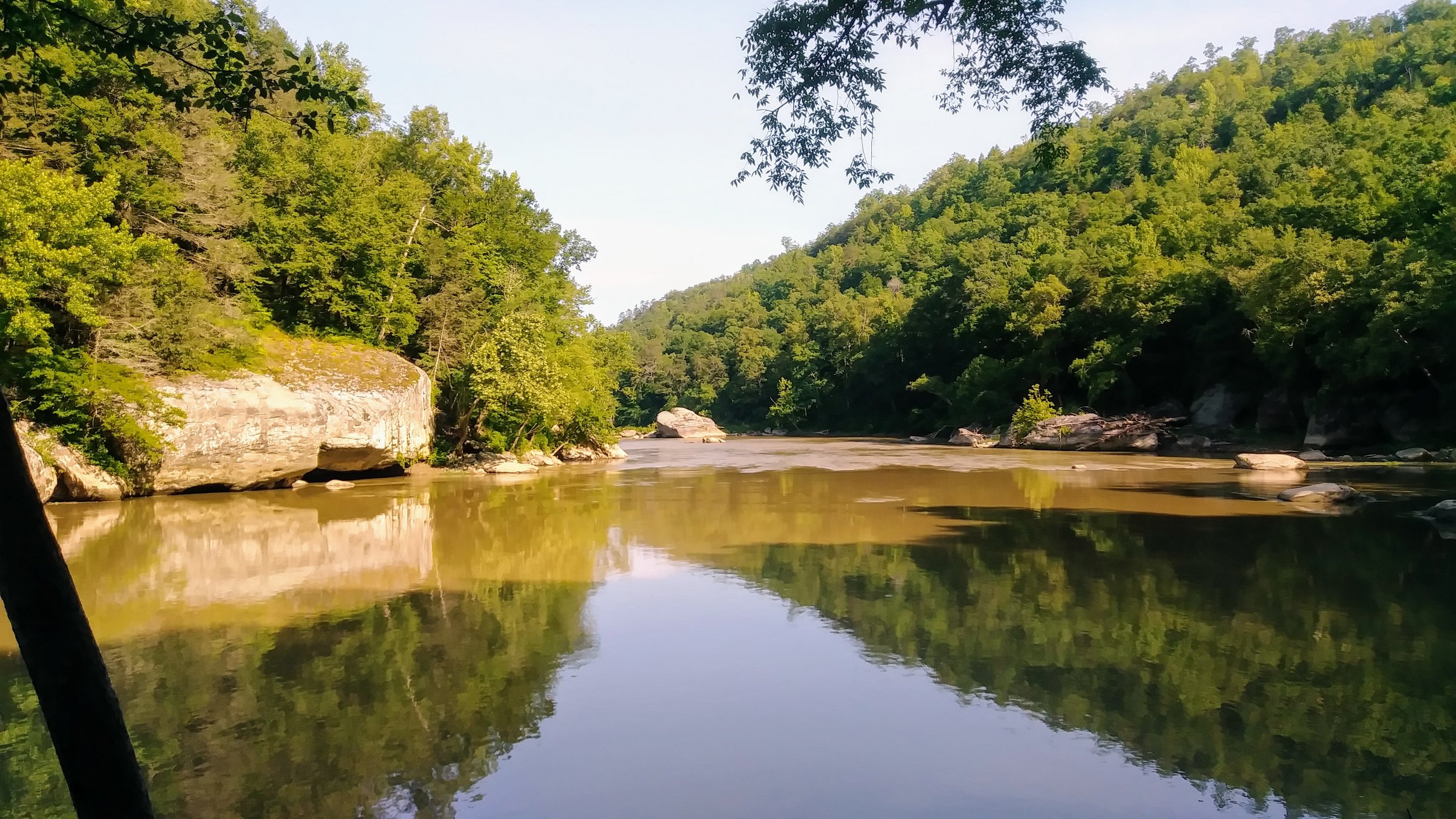
A calm bend in Cumberland River from Sheltowee Trace
Cumberland Falls from the most distant of five observation decks
A beautiful cascade on Eagle Falls Trail Loop (Trail 9)
Eagle Falls on a hot summer day
A view of Cumberland Falls from Eagle Falls Trail


